
A sweeping new plan to reshape Pacific Coast Highway over the next several decades was unveiled this week, as state transportation officials presented the Draft PCH Master Plan Feasibility Study during a public meeting that drew both praise and sharp criticism from residents and local officials.
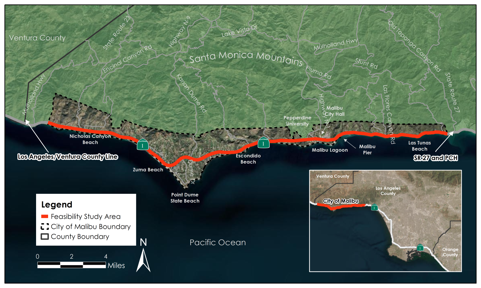
The California Department of Transportation outlined a long-term strategy aimed at improving safety and mobility along the 21-mile stretch of PCH that runs through Malibu. The plan includes proposed roundabouts, expanded sidewalks, protected bike lanes, traffic calming measures, improved pedestrian crossings and increased parking near coastal access points. Officials emphasized that the proposals are conceptual and subject to change during future phases of design and funding.
Ryan Snyder, a transportation planner working with Caltrans District 7, led the presentation and said the plan was developed in response to longstanding concerns about safety on one of California’s most heavily used coastal highways. The plan was informed by extensive public outreach, including surveys, charrettes, workshops and stakeholder meetings held between July and September of 2024.
“People want change,” Snyder said. “When we asked the public about leaving the highway as it is, that option came in dead last every time. The community has been very clear in asking us to make the highway safer.”
Among the plan’s proposed features are nine roundabouts, with the largest located at Webb Way to serve as a potential gateway into central Malibu. Sidewalks would be added in multiple locations where they are currently missing, including segments near Carbon Canyon Road and Los Flores Canyon. The plan also calls for protected or buffered bike lanes along nearly the entire corridor, staggered beachside parking and improved crosswalks at busy intersections and transit stops.
To accommodate these changes, Caltrans is considering reducing the number of travel lanes in some locations and removing on-street parking along one side of the highway. Snyder acknowledged the trade-offs involved and said the final design choices would depend on input from city officials, community members and environmental reviews.
Several proposed cross-sections would require the elimination of center turn lanes or medians in order to make room for sidewalks and bicycle facilities. In other sections, travel lanes would be narrowed to 11 feet to help fit the new infrastructure within the existing right-of-way.
Some residents raised concerns about the practicality of the proposed changes, particularly the addition of protected bike lanes in areas with limited driveway visibility. Joan Zoloft, who lives near La Costa Beach, said that new barriers could interfere with access to homes and worsen safety risks.
“If you made medians that prevent turns into our homes, where are we supposed to go?” she asked during the meeting. “I’ve seen people wiped out by car doors and speeding vehicles. I just don’t think this has been thought through clearly.”
Other participants questioned whether the plan accounted for recent wildfire damage and the ongoing reconstruction effort across Malibu. Wade Major, a public works commissioner who said he was speaking in a personal capacity, urged Caltrans to delay implementation until after the city had recovered.
“These projects are being proposed during a period when we are still rebuilding Malibu from the fires,” Major said. “You are going to create horrible choke points and chaos if you move ahead now.”
Snyder responded that the Master Plan is strictly a feasibility study and that implementation could take decades, depending on funding availability and public support. He said the plan was designed to be flexible and would evolve over time to reflect changing needs, especially as Malibu continues its recovery.
“None of this is final,” Snyder said. “There are options at nearly every segment and which option gets selected will depend on what the community and decision-makers ultimately want.”
The plan also explores the possibility of reverse-angled parking near popular beaches, speed reduction strategies such as raised crosswalks and quick curbs and gateways with public art to signal entry into Malibu. Snyder noted that roundabouts could reduce collisions and improve traffic flow by eliminating the need for turn lanes.
Not all attendees were opposed to the plan. Colin, a participant who raised several design questions, asked whether Caltrans would consider using daylighting buffers around driveways to improve visibility for cyclists and drivers. Snyder said those issues would be addressed in future design phases and were not detailed in the current draft.
Several attendees asked about how the project would be funded. Snyder explained that no funds have yet been allocated and that implementation would likely be phased over 10 to 30 years. He said options for funding could include state and federal grants, revenue from parking fees or traffic cameras and potentially a local benefit assessment district if Malibu residents supported it.
Some features, such as buffered bike lanes and quick curb installations, could be implemented relatively quickly and at lower cost. Other improvements, including major roundabouts and full corridor redesigns, would require more extensive engineering, environmental review and political coordination. Estimated costs for the complete plan range from $62 million to $268 million, depending on which design options are ultimately selected.
Halen, a resident who also spoke during the meeting, questioned whether Caltrans had engaged the Malibu City Council directly and urged the agency to formally present the plan to elected officials. In response, Snyder said Caltrans had been coordinating with Malibu’s city engineer but would be open to presenting the study directly to the council if needed.
Public comments on the Draft PCH Master Plan Feasibility Study will be accepted through June 9. The full report is available on the Caltrans engagement portal at engage.dot.ca.gov/f1336. Comments may be submitted directly through the site or via email.